Why Drone Surveys Make Going Solar Easier, Faster, & More Accurate
Updated January 2026

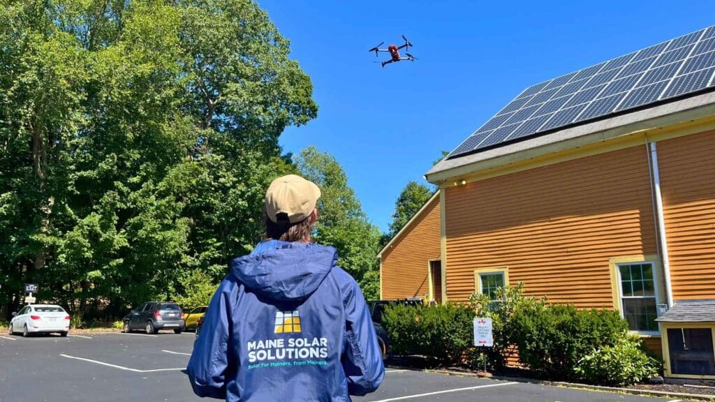
Drone surveys are now central to how we design solar systems in Maine. By capturing precise aerial data and transforming it into 3D models, we simplify the entire process — from your initial consultation through to installation.
What started two years ago as a safety tool has become a powerful design resource. Today, our drone program improves turnaround times, increases pricing accuracy, and enhances the customer experience. To show you how it works, we sat down with Lead Drone Operator Tommy Begin for a behind-the-scenes look.
Q&A with Tommy Begin, Lead Drone Operator
Q: Tommy—what’s been the biggest surprise about MSS’s drone program for you?
A: Honestly, how much fun it has been to fly drones and educate our customers. With something like drones, there are always big questions and concerns surrounding liability and safety, but we have a solid team to help navigate any hurdles, so the fun is never far away.
Q: Why does MSS use drones for site assessments?
A: We use drones for site assessments for several reasons. First, they help us reduce risk and liability associated with roof-line surveys. Even with strict OSHA training, climbing on roofs can pose safety concerns. Safety matters to us deeply. Drones also boost accuracy and efficiency across our process.
Q: Why wouldn’t you use a drone on some homes or businesses?
A: While drones are ideal for most sites, there are a few situations where we may not fly. If the property is heavily wooded, has a limited line of sight, or is located near restricted airspace (such as near airports), flying a drone may not be safe or effective.
Q: What kind of certification is required to fly drones professionally?
A: To fly drones commercially, our pilots hold the FAA Part 107 certification under Title 14 of the US Code of Federal Regulations. This lets us operate safely and professionally at Maine Solar Solutions.
Q: What does a typical drone survey look like?
A: Here’s how a typical drone survey works:
• For most homes, the survey takes about 10 minutes (up to 20 for commercial sites).
• We fly two “orbits” around the property and capture over 100 high-resolution photos.
• Using photogrammetry tools, we turn those photos into a geo-located 3D model.
• Within hours, our design team uses that model to build your custom solar layout.
Q: Can you fly in winter?
A: Yes—we fly year-round. Our drones are built to operate in cold temperatures, so winter surveys are no problem. The only exception is severe weather—if we’re dealing with heavy snow, high winds, or lightning, we’ll reschedule to keep things safe for our pilots, equipment, and the homes we are flying.
Q: What are some benefits most customers might not think about when using drones?
A: There are several benefits, but the biggest are faster surveys, fewer surprises on install day, and a smoother experience. Drones capture precise measurements and images in a fraction of the time, so that you can meet with your solar consultant sooner. That accuracy means your design is right the first time, pricing is more transparent, and last-minute changes to design and pricing are less likely. We can also show you precisely what your system will look like before it’s installed — giving you confidence in the plan and keeping your project on track.
Q: How many homes and businesses have we surveyed by drone since 2023?
A: Since coming online with the drone program in the spring of 2023, we have completed roughly 3500 drone surveys.
Q: Speaking of confidence… do neighbors ever get concerned about the drone flying?
A: They can, and it makes sense. There is a lot of misinformation about drone technology, as well as heightened concerns about privacy in the world. The beauty of our process, though, is that we will always take an educational and informative approach with anyone we talk to. It’s important to us that we stay transparent, hence why we notify neighbors when we survey a home. It is certainly fun having conversations with folks about drones and the technological edge they can provide.
Q: Any fun facts or unexpected moments from the past two years?
A: There have been a few times in the last year that a curious neighbor came to say Hi, and we ended up surveying their home and scheduling an appointment for them with one of our solar consultants. That’s always fun. Our team has also encountered a few curious birds, namely hawks and osprey.
Q: What’s next for the drone program or technology?
A: Really, for us, it’s about supporting the business in as safe and flexible a way as possible. We aim to grow in any way that our industry demands, and for us, that looks like achieving new levels of expertise, taking on new training where we can, and keeping an open mind about how drones can serve the larger mission at Maine Solar Solutions.
Locally Flown. Expertly Designed.
We’ve been designing and installing high-performing solar systems in Maine for over 13 years. Our drone program is the latest way we’re continuing to innovate—improving safety, streamlining design, and giving customers an even more accurate and personalized experience.
As one of the first local solar installers in Maine to adopt drone-assisted design, we’re proud to combine cutting-edge tools with the personal service our customers have come to expect from us. Our FAA-certified drone pilots capture complex rooflines and model full system layouts. This helps us deliver faster, more accurate, and more customized solar solutions here in Maine.
Ready to move forward?
Book a drone site assessment today. We’ll create a custom solar design based on your property, goals, and budget. Call us at (207)-871-7191 or schedule online here to get started.

